
ADJUST operates as a natural extension to AutoCAD or BricsCAD, with all user selections handled by the CAD interface, allowing you to use object snaps and entity selection options throughout. All processing takes place inside AutoCAD.
The Calibration Manager
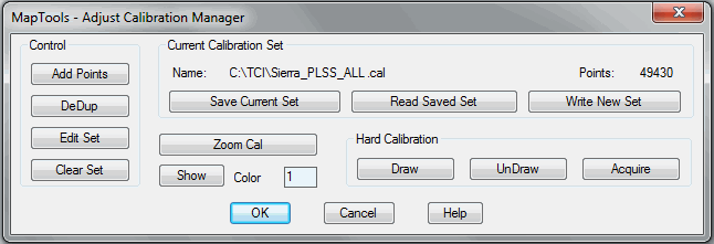
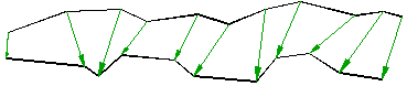
The first, most critical and time consuming operator task of the rubber sheeting process is setting the Calibration Point Set which controls the action of all processing. Since Adjust allows unlimited Calibration, a Calibration Manager is used to help you to construct, save, recall and modify these FROM – TO point sets. Point sets are displayed as graphic elements (in any color), represented by an arrow with the arrowhead on the TO end. The size of the arrowhead is scaled in relationship to the length of the calibration pair.
Large Projects
The Calibration Manager is a vital tool when constructing calibration sets for large projects.
Densify Modes Automate Calibration Selection
In addition to the standard calibration selection method [ pick 2 points ], Five Densify Modes are available to automate the setting of multiple Calibration Pairs.
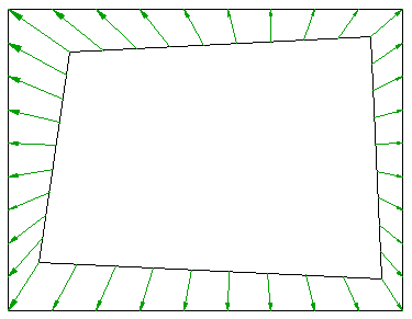
Boundary Mode can be used to create a frame from four corner points.
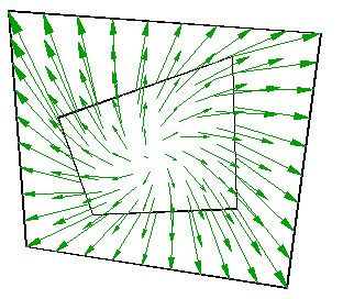
Full Mode will completely cover an area based on four corner points.
Two Point Mode will automatically interpolate any number of Calibration Pairs between two sets of points.
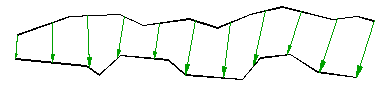
Polyline Densification allows you to automatically create Calibration Pairs connecting Polyline Entities. Two modes are available; the Divide Mode will create any number of evenly spaced Calibration Pairs between two Polylines, while the Vertex Mode will create new Calibration Pairs between vertices. All Densification Modes create 3D Calibration, including Polyline modes. Polyline densification creates point sets between 2D and 3D Polylines or 3Dmeshes.
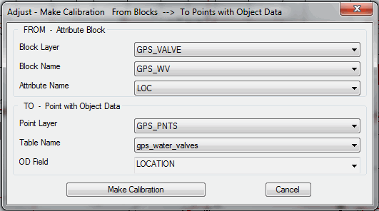
Creating Calibration using GPS Data
Adjust can automatically create new calibration data using Attribute Blocks and Points with Object Data (OD). This function requires AutoCAD Map.
Attribute Blocks are commonly used to represent map features, such as water valves. In many cases, these blocks contain at least one attribute to store some form of unique identifier. When GPS field data is collected for these type features, it can be imported into AutoCAD Map and stored as Points with Object Data. If the same unique identifier is entered when collecting the GPS field data, Adjust can automatically create calibration pairs using Block Attribute data as the From point and the GPS Point with the same identifier as the To point.
Editing Point Sets
Perhaps the most refined new feature of Adjust is the Calibration Editing capability. A new AutoZoom feature will automatically center your view on the current calibration pair so you can quickly review all calibration by picking the Next and Prev buttons. The new Focus feature will sort a large calibration set in proximity order from a Focus Point you select. If the calibration set is very large (1000’s of pairs ) you may want to limit the sort to only those points within a set proximity to the focus point.