
Our first test flight of the Samsumg 360 Gear camera.
Category Archives: Uncategorized
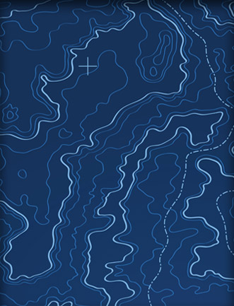
360° Panoramic Photo – 400’AGL
360° Panaramic Photos of our Headquarters in Ontario
360° Panoramic Photo – 100′ AGL
360° Panaramic Photos of our Headquarters in Ontario
Converting Adobe Illustrator Splines for the Best Possible Cutting Path
Introduction
Designers commonly use Adobe Illustrator to create cutting paths to control automated machine tools. The output files (.AI) often include mathematical splines to represent that path. Most cutting machines require a G-code compatible format, one with just lines and arcs but no splines, to guide their work.
This article details how to convert a .AI file cutting path to a format that can be used to make a G-Code file to guide the cutting operation with the best possible results. The process involves taking advantage of CAD packages’ spline conversion tools and knowing how to optimize the resulting polylines.
CAD Packages and Splines
Both BricsCAD and AutoCAD have built-in spline converters that will turn Adobe Illustrator splines into polylines comprised of line and arc segments.
New 2016 – Beginning with BricsCAD v16.2, the conversion of Splines to Polylines with BricsCAD works the same as AutoCAD. Most notably, BricsCAD now honors the PLINECONVERTMODE system variable and the PRECISION variable is included to control the resolution of the converted Polyline.
Using AutoCAD or BricsCAD to process the Splines into optimized Polylines ready for G-Code creation is now the same process (BricsCAD v16.2 or later).
AutoCAD and BricsCAD have two settings that impact how the spine is converted to lines and arcs: PLINECONVERTMODE and PRECISION.
PLINECONVERTMODE
The PLINECONVERTMODE variable controls how the spline is represented as a polyline. If this is turned on (1), the output polyline will potentially include arcs that introduce errors.
Figure 1 shows part of a sign cutting pattern from Adobe Illustrator. The PLINECONVERTMODE variable was set to 1 (on), indicating that the output polyline from the PEDIT command can include arcs. The original spline is green and the output polyline red. The callouts reveal how arcs are incorrectly added to the design, changing the design intent. This incorrect conversion is present in both AutoCAD and BricsCAD conversions.
The good news is that when PLINECONVERTMODE is set to 0 (off), indicating that the output polyline from the PEDIT command should not include arcs, none of these errors are present. So, for best results, set PLINECONVERTMODE to 0 (off).

Figure 1. Setting the PLINECONVERTMODE variable to 1 can introduce errors during spline conversion.
PRECISION
When converting splines with AutoCAD (2012 or later) or BricsCAD (v16.2 or later), the PRECISION setting controls how accurately the resulting polyline will fit the original spline: the higher the setting, the more accurate the conversion. The default PRECISION is set to 10; the value can be set to any integer between 0 and 99.
Here are some examples of the effect of a low PRECISION setting, 10, when using PEDIT. Figure 2 below illustrates how linework can be moved and figure 3 shows how curves can be overgeneralized, changing the design intent.

Figure 2. Setting PRECISION too low can move linework during conversion from splines to polylines.

Figure 3. Setting the PRECISION variable too low when converting splines to polylines can remove intended smoothness.
Setting the value is straightforward. Currently, the only way to set the PRECISION value is to run the PEDIT or SPLINEDIT (AutoCAD only), pick any spline entity and then input the desired Precision value. The setting will be remembered for the duration of the drawing session.
Determining the PRECISION value is a bit trickier, but in general use a higher rather than a lower value to maintain the accuracy of the design. Do note that a higher value will create many more vertices and possibly slowdown processing. But when the workflow is to Curvefit the resulting converted Polyline, more vertices is usually preferable because the shape is more accurately defined.
Using a higher setting for PRECISION is the resulting polyline will contain a lot more points. That, in turn, means the G-Code generated from that polyline could have too many points in the cutting path for the cutting machine to execute the job.
Adding just one additional mathematical conversion can solve that problem. TCI Software’s Curvefit will maintain the accuracy of the polyline and dramtically lower the number of points so the cutting machine can do its work efficiently.
Final Workflow
The workflow to convert a .AI file with splines to a usable polyline for G-Code creation involves two steps:
- Convert the splines into polylines that accurately fit the spline shape (using the guidance above).
- Curvefit the polylines (from BricsCAD, AutoCAD or other sources) with a tight tolerance.
TCI’s Curvefit optimizes polylines created with high or low PRECISION, so there’s no reason to degrade a .AI design with low PRECISION value when converting splines. To get the most accurate polyline to use in generating your G-Code, use your CAD package wisely, then use Curvefit.
Seeing is Believing
The resulting curvefitted polyline of the letter “C” in Figure 4 is actually 38% more compact than the original .AI spline. The processing noted shows how the 70 control points in the original spline were converted to just 43 lines and arcs in the final polyline. The original and the final match to within one part per 1000.

Figure 4. Processing an .AI file with AutoCAD and Curvefit.
Set PLINECONVERTMODE to zero (OFF); choose a high PRECISION before using PEDIT to convert splines to polylines. Then use Curvefit with a tight tolerance to optimize the polyline.
The original file included 70 controls points; the final polyline, just 43.
We offer a free fully functional demo of Curvefit for AutoCAD, BricsCAD, ZWCAD or the Stand-alone version which does not require a CAD platform.
Do you need smoother contours and smaller files for your mapping projects?
Many mapping projects make use of contour data. Some contour datasets are processed from LiDAR or other data collections while some come directly from a data provider like USGS in a GIS or CAD format. Depending on how the data were collected or processed they may be accurate, but coarse. And, it’s likely the data files are quite large. How can you keep the contours accurate, but make them smoother and the files smaller? TCI Software’s MapTools Pro has the tools to do just that, and a whole lot more.
The Workflow
Here’s a bit of a USGS contour dataset. The entire dataset has 359 straight segments.

The MapTools PNURBS tool creates polylines using true spline entities (including mathematically defined curves) using every vertex of the original data. That means the new linework will pass through every vertex in the original data. The output polylines are very smooth.

But, they have a lot of vertices: 2853!

The MapTools Curvefit tool [also available as a standalone app for use with any CAD, GIS or graphics package] can simplify the linework and reduce the file size. Curvefit creates straight and curved linework that passes through all of the original vertex locations but with fewer vertices. The final dataset has just 197 vertices – a 93% decrease!

Want to see what MapTools Pro can do for your contours?
Try a 30 day free trial. If you have BricsCAD or AutoCAD, MapTools Pro licenses start at $595. If you don’t have a CAD package, MapTools Pro and BricsCAD are available for just $995 for a limited time, a savings of $300 off separate purchases.
Bricsys Supports OGC WMS … and Many other Mapping and GIS Functions
Did you know BricsCAD Supports WMS?
Many GIS and CAD users might have missed the news that the latest release of BricsCAD supports the Open Geospatial Consortium’s (OGC) Web Map Service (WMS) specification. BricsCAD 15.2, the low-cost AutoCAD work-alike was released in April 2015 and can access data from any map server supporting the interface standard.
The graphics below show BricsCAD connecting to, and loading data from a NearMap map server. NearMap is an Australian imagery company that provides data via WMS to GIS and CAD software.

BricsCAD Connecting to a NearMap Web Map Service (Click for larger image)

WMS Data Inside BricsCAD (Click for larger image)
BricsCAD is More than just a WMS Client
BricsCAD can do more than display map data from servers. It’s a powerful CAD package on it own! And paired with tools from TCI Software, BricsCAD can tackle many demanding mapping jobs.
MapTools speeds up feature and attribute editing and cleans dirty data and text. It includes tools that simplify working with blocks, EED, layers, polylines, and text.
MT Symbols is a symbol library and management tool. The library includes symbols for public works, recreation, and vegetation as well as north arrows and scale bars. There are also symbols for use with BLM and USGS maps.
MT-Automation is a toolkit for automating BricsCAD workflows.
Adjust adds true rubbersheeting to BricsCAD. Unlike other solutions, it enables “non linear stretching in many directions simultaneously” and supports an unlimited number of data calibration pairs.
Curvefit works alongside BricsCAD to provide smooth, accurate, tangent linework from coarse contour lines and similar features. While making linework more attractive, Curvefit reduces both the number of vertices and the data file size.
Are you an AutoCAD user? Don’t worry all of these TCI Software tools work with AutoCAD, too.
Curious? Try a free trial of any of these tools today!
What is Rubbersheeting?
Esri offers this definition in its dictionary:
“A procedure for adjusting the coordinates of all the data points in a dataset to allow a more accurate match between known locations and a few data points within the dataset. Rubber sheeting preserves the interconnectivity between points and objects through stretching, shrinking, or reorienting their interconnecting lines.”
At TCI Software, the definition we use defines “True Rubber Sheeting” as “Non linear stretching in many directions simultaneously.” Unlike most other rubbersheet processors, our Adjust software allows Unlimited Calibration – any number of Calibration Pairs (FROM point & TO point) which can be arranged in any pattern, even so-called unstable or conflicting patterns.
Adjust manipulates drawing entities to perfectly simulate True Rubber Sheeting. It runs as an extension to AutoCAD or BricsCAD, is simple to operate and produces error free results. Based on a proprietary non-projective algorithm, Adjust has been used to process thousands of maps in a wide variety of production mapping applications for over 20 years.
See how we rubbersheeted this 25 square mile city using over 62,000 calibration pairs in the video below.
Curious? Get a 30 day free trial!
Three Reasons to Get to Know TCI’s Industry-Leading Mapping Software

- TCI’s Adjust accurately rubbersheets vector data to match an image or dataset.
- June 18, 2015, Baker City, OR, – If you create or edit maps, you most likely use Esri’s ArcGIS, Autodesk’s AutoCAD, or open source QGIS. Are those the best options for your work and your budget? If you’re not sure, it’s time to consider TCI Software’s products.
- 1. TCI makes software that addresses real world mapping problems. TCI offers advanced rubbersheeting to intelligently adjust one dataset to fit another, customizable curve fitting to accurately simplify complex curves while reducing file size, and complete solutions to create 3D corridor maps for linear features like pipelines.
- 2. TCI products run on AutoCAD or the low-cost AutoCAD work-alike BricsCAD. If you have existing AutoCAD seats, TCI tools will run as extensions. If you don’t, you can purchase a complete mapping seat based on BricsCAD for under $1000, less than one quarter the price of AutoCAD alone.
- 3. TCI offers all its products as fully functional 30 day free trials. TCI invites you to try its products to see if they fit your needs. You’ll soon find out why nearly all trial users become avid TCI users.
- About TCI
- TCI Software has developed mapping and mapping automation tools for more than 25 years. The company joined the Autodesk Developer Network in 1991 and became a BricsCAD Solution Partner in 2013. The product line includes individual tools like Adjust for rubbersheeting and Curvefit for optimizing linework while dramatically reducing file size, packages like MapTools Pro for automating a variety of tasks, and CoriMap, for creating 3D corridor maps that support slope stationing. TCI offerings evolve as users around the world, including TCI staff, tackle today’s mapping challenges.
ABOUT OUR MAPPING SERVICES
We not only offer software products but are continually involved in mapping service projects. Over the years we have worked for or with large firms such as AT&T, Conoco Pipeline (now Phillips 66), David Evans & Associates, Fluor Daniels, Level 3, Parsons Brinkerhoff, RCN and others. Most of these projects involved Corridor mapping projects for Pipeline of Fiber Optic Cable, using our 3D Corridor mapping applications – one of the few products that support Slope Stationing and Slope Station Profiles.
Our involvement with Government agency mapping project began early on with many Basemap production projects, building the original map base for the City of Portland and the Metro RLIS project. That early map base production experience also included a number of smaller municipalities in Oregon such as The Cities of Beaverton, Gresham, Lake Oswego, Milwaukie, Oregon City & Tigard.
Each of these projects presented new challenges which usually led to addition of new software tools made a part of our MapTools product. Our Adjust – Rubbersheeting tools was one such product, developed to facilitate and automate the creation of a seamless basemap from 100’s to 1000’s of individual maps. Our expertise in Rubbersheeting led to many more large, complex rubbersheeting projects for clients such as Navajo County Arizona, Sierra County California, Ceres California and Lake Oswego Oregon.
For the past 11 years we worked for Payette County Idaho, building and maintaining their Assessor maps as well as specialized map products for virtually every department in the County including a 911 mapping system for dispatch and more than 40 mobile workstations. Our Automated Mapping tools offer solutions to everyday tasks because we have continually been involved in mapping projects that present new challenges and with each new challenge we create tools to address those issues and add them to MapTools. They work because we work.
About TCI
TCI was founded more than 25 years ago when the founder Tom Inloes began working as a CAD draftsman for a large engineering firm (David Evans & Assoc.) working on a large Fiber Optic Cable project with AT&T. Our first product the Parametric Editing Tools (PET) was introduced in 1989 and when reviewed by Civil Engineering News was touted as PET could be AutoCAD’s best friend. TCI became a member of the Autodesk Developer Network in 1991 and in 2013 became a Solution Partner with BricsCAD. Over the years, our product line has expanded and has been continually maintained to work with the latest version of AutoCAD – and now BricsCAD.
We have focused on Automated Mapping since day one because the promise of Automated Mapping is the ability to create map products that meet high standards with high efficiency. When an automated mapping process is created to change some characteristic of a map or group of maps, the results can be the accomplishment of thousands of drafting operations with a single pick of the mouse. Furthermore, when automated mapping techniques are employed, you can be assured that 100% of the desired changes have been made.