
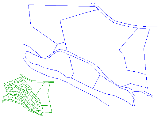
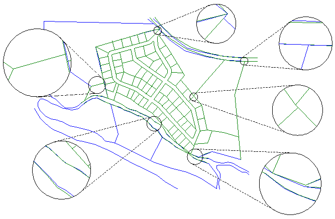
This example illustrates the edge matching process using ADJUST to add a new subdivision (shown in green) into an existing map (shown in blue).
First, the new subdivision drawing is inserted into the existing map in a place where it can be easily picked.
Several calibration pairs are then picked (shown in Red), using AutoCAD osnaps, to precisely define points that should coincide.
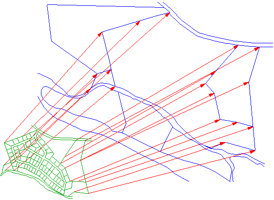
When all calibration pairs have been chosen, the next process is called “best-fit”. Best-fit performs a linear Scale, Rotate and Move operations to minimize the distance between calibration pairs.
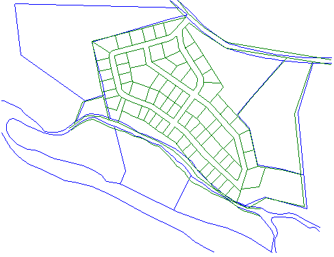
This close-up view shows the calibration pairs (in RED) after Best-Fit has been accomplished. We now add 100 more calibration pairs along the River border which should coincide. This is easily accomplished by using the Polyline Densify option. You simply pick the two polylines (river borders) which should coincide, and tell ADJUST to add 100 calibration pairs connecting them.
After all calibration pairs have been selected, and the Best-Fit process performed, you proceed to rubber sheeting. At this point, you have the option to “fracture” long lines and/or long arcs at a selectable distance.
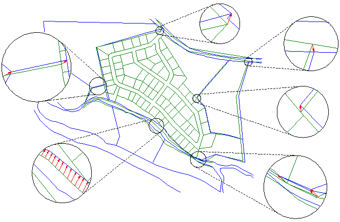
This close-up view after rubber sheeting shows the Zero Error result at every calibration point, with the new subdivision rubbersheeted into the existing base map.