
Processing a Manual Walkout
A step by step approach
This is a description of the process used to create a CoriMap standard drawing using manual walkout notes. Once the information is entered, the drawing can be processed using all of CoriMaps automated tools.
Create a Basemap
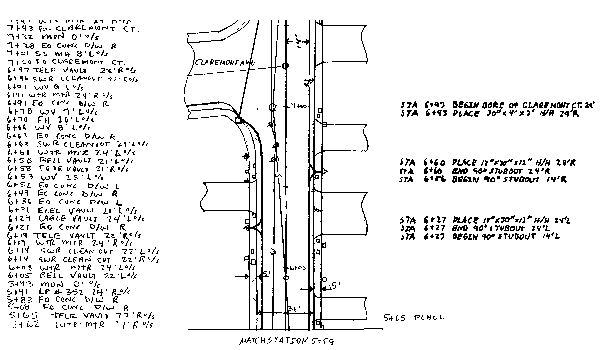
The first step is not automated by CoriMap – it is to acquire or create a basemap . This basemap must have at least one feature, one or more polylines to be used as the Baseline. In this example, the walkout notes tell us that the street is 36 feet wide and shows the ROW as 5 feet beyond the curb.
Enter the Data
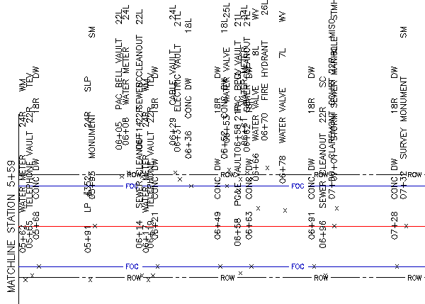
Our next step is to enter the field data using the CoriMap Place Blocks function. Each feature is processed to insert a generic attribute block and populating it’s 4 data fields: Station, Offset, Feature Code and Label.
This is a somewhat time consuming task, but the data entry operator does not need to know anything about the final format of the drawing, instead they just focus on reading the paper document and accurately entering the information.
This group of features was entered in just a couple of minutes.
Redefine the Blocks
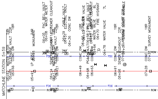
The next step is to replace the generic blocks with project specific blocks . Using CoriMap’s Block Redefine function, all blocks are replaced with our chosen standards. This process is totally automated, the time to complete this sample: 1 minute. In fact, groups of drawings can be processed Unattended.
Arrange the Attributes
The next step uses the automated attribute arrange tool in Auto Mode. Time to complete: 1 minute
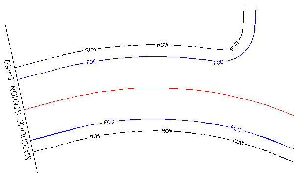
Wait a Minute – that street isn’t supposed to be straight
It seems this field crew sketched the example street as straight when in reality the street is curved. One option would be to start over with Place Blocks and re-enter the data. But we have a better alternative.
Change the Basemap
To solve this predicament, we simply generate the correct linework, making sure the new linework starts at the same point as the old (at the matchline). Here we see 2 baselines (in red) with the old Face of Curb and ROW removed and replaced by the correct linework.
An Instant Fix
With the new linework in place, we use CoriMap’s RePlace Blocks function. This function automatically moves each block to its new correct location, based on the stored Station and Offset values.
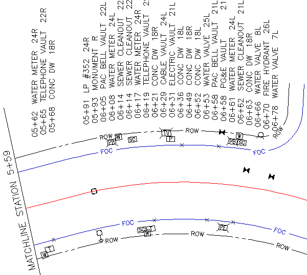
The final 2 tasks are also automated: Orient Blocks to rotate the block graphics to align with the new baseline and Arrange Attributes. Total processing time: less than 1 minute.