
Object Data has been a part of AutoCAD Map (in one form or another) for many years. MapTools includes a number of Object Data oriented functions and capabilities. As is the case with All MapTools functions, these work with all versions of AutoCAD Map from V3 to the latest version. (Not Compatible with BricsCAD).
PolyTools Maintain Object Data
Manipulate Linework without losing Object Data
Now you can manipulate linework (break, join, connect, insert new vertices, create and modify bulge segments, straighten, reverse, etc.) without losing the Object Data. In fact, when you Join or Connect linework with Object Data attached, the new entity will have Joined Object Data.
Linework Annotation using Object Data
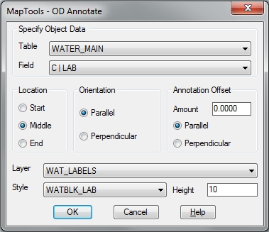
Create new “linked” Text Labels from Object Data
This new function is incredibly useful for creating Text labels from the contents of Object Data fields. It offers so many setup options you can create practically any style of labeling you can think of, directly from Object Data attached to Line and Polylines.
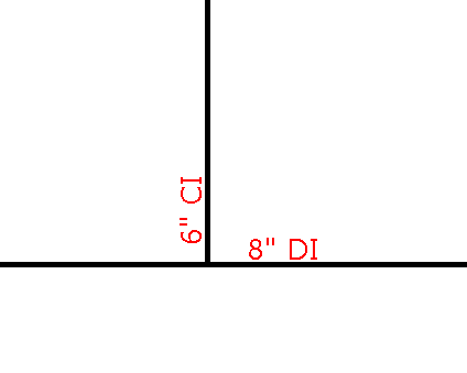
Text Annotation can be created from Character fields AND Numeric fields. Using PET, you can even assemble new labels using multiple Object Data fields and freeform text such as this waterline label (assembled from an Integer “Size” field and a Character “material” field with a ” inserted between them).
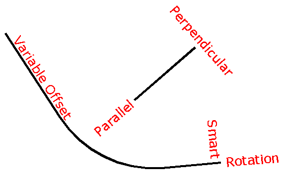
Labels are created as plain Text entities using the Layer, Style and Height setting you choose. Each new Text label is created with an identical copy of the Object Data attached to the linework. Text can be positioned relative to either end of the linework and the appropriate Text Justification is always used (it will still look right even when you change the text height).
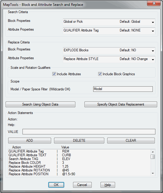
Object Data Search and Replace
PET includes Object Data as Search and Replace Criteria
All PET menus include Object Data capability for both Search and Replace operations. A number of special operations are also available for Object Data including:
- Search Character Object Data using Wildcards
- Search Numeric Object Data using Ranging
- Replace Character Object Data using Prefixing and Suffixing
- Replace Numeric Data using Setting, Scaling, Offsetting and Rounding
- Calculate and Store Length, Area and Start/Insertion Points in Object Data Fields
Combine multiple operations using MapTools Commander
Many Object.Data Search and Replace operations can be combined and performed as a group using MapTools Commander.
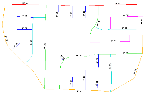
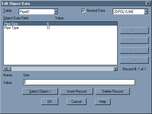
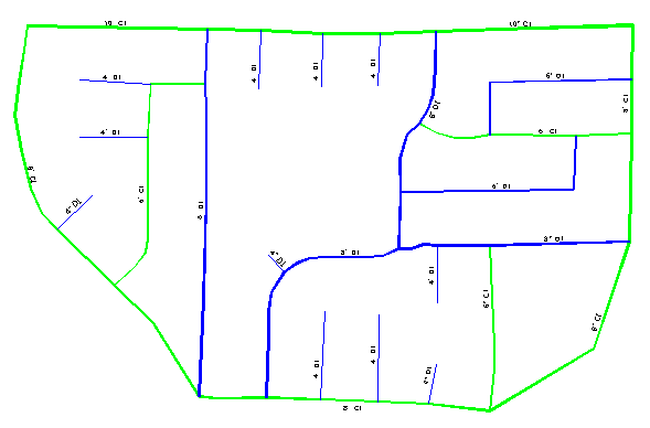
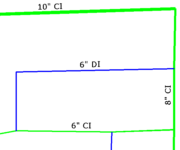
This example shows a water distribution map that uses color to distinguish pipe size and material (Click here for a close-up view). The first operation searches for linework based on its color and sets Object Data for both Pipe Size and Type (material).
Since PET allows you to Search based on Any Combination of Properties, the possibilities for setting Object Data based on Layer, Color, Linetype, Elevation, etc. are practically limitless.
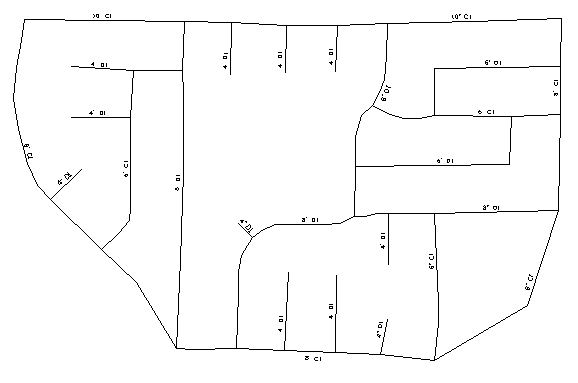
To fully process this example, a MapTools Commander operation runs PET 12 times (once for each color and Object Data setting). After all map entities have been set, the linework colors are all set to Bylayer. Here’s a view of the map after all changes are complete and the Object Data has been set.
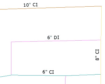
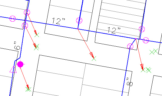
Next we run another MapTools Commander operation to Search for linework based on Object Data settings. We change the Linework Width based on the Object Data Pipe Size and the change the Linework Color based on the Object Data Pipe Type (a close-up view).
Rubbersheeting using Object Data
Adding Rubbersheeting Calibration using GPS Data
Adjust can automatically create calibration data using Attribute Blocks and Points with Object Data.
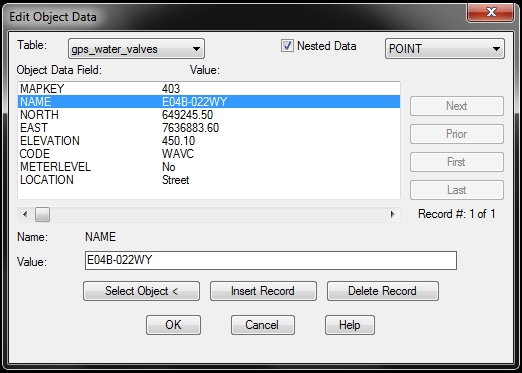
Attribute Blocks are commonly used to represent map features, such as water valves. In many cases, these blocks contain at least one attribute to store some form of unique identifier. When GPS field data is collected for these type features, it can be imported into AutoCAD Map and stored as Points with Object Data. If the same unique identifier is entered when collecting the GPS field data, Adjust can automatically create calibration pairs using Block Attribute data as the From point and the GPS Point with the same identifier as the To point.
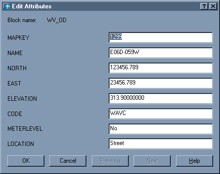
Convert Points with Object Data to Attribute Blocks
ODATT. is a function in MapTools (Basic & Pro). It creates attribute block representations of Points that have Object Data attached. (Menu) A new attribute block is created in your drawing that contains one Invisible Attribute for each Field in the chosen Object Data Table. Here’s an example of a Point with Object Data and the equivalent Attribute Block created by ODATT.