
QC Profile – Profile Inspection and Repair
Resolving GPS elevation irregularities
CoriMaps QC Profile function was created in recognition of the fact that a 3D mapping product can not truly be accurate unless elevation errors are discovered and corrected. Baseline profiles from one or more drawings can be quickly inspected to identify elevation anomalies and specify corrections.
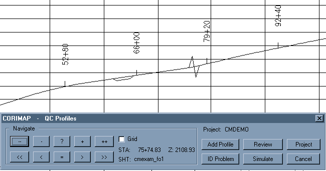
A highly automated dialog box interface guides the user through the steps of inspecting the baseline profile and identifying problem areas. The navigator buttons perform zooms and pans while keeping the baseline profile centered in the display.
Elevation repair operations include Smoothing between vertices (interpolated) or Moving groups of vertices up or down in Z. Once all problems have been identified, a Simulation operation displays the baseline as it will look if all corrections are accepted. Is so, all files necessary to repair the individual sheets is written.
Fixing Profiles
Fix Profile is a function that can be run from the command line or in Batch to apply the elevation modifications specified by QC Profile.
REZ – Assign New Z Values
This function modifies the Z values of the vertices of baseline polylines by replacing them with the Z value of a 3D coordinate read from a disk file. The purpose of this function is to allow existing polylines be converted to reflect a new datum. The REZ file is assumed to be a standard ASCII file with comma delimited coordinates, one per line of the form X.Y.Z