
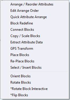
Specialized Block Tools
CoriMap includes a number of specialized Block tools designed to address situations often encountered in corridor mapping applications.
Block Redefinition
With this tool, you can replace Block definitions and Block Insert with a predefined Gospel Block. Replacement blocks can maintain all characteristics during replacement: Scale, Rotation, Attribute Position, Rotation, Height and Justification.
Click Here for more Details.
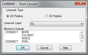
Connecting Blocks with PT Connect
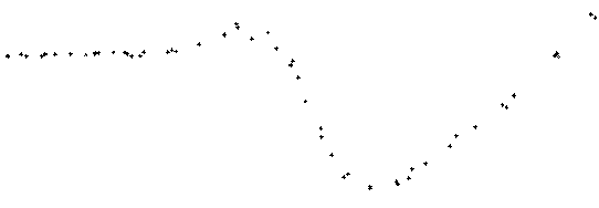
The PT Connect tool was built specifically to draw polylines between GPS Point Blocks, although it will work with any block. In some mapping projects, GPS Point data is collected for linear features such as the road centerline or a fence line. These linear features must then be created by “connecting the dots“.
Another common requirement is to create a single piece of linework that connects several different block types. An example of this would be to draw a proposed Fiber Optic cable corridor route by connecting “points on” represented by the FORL Block and “Begin & End Bore” points represented by BORE Blocks. The PTConnect Dialog Box allow the selection of any number of block names for connection.
Copy / Scale Blocks
The CSBLKS tool was originally created to quickly produce a set of Scaled feature blocks to be used for different scale plots. The user specifies settings using a command line interface that allows:
- the automatic selection of Blocks based on a Layer name spec
- automatic Relayering of the copied Block
- changing the Scale Factor for the Graphics portion of the Block
- changing the Scale Factor for any Attributes associated with the Block
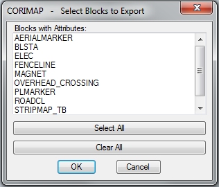
Extract Attribute Data
In some cases, the information stored in attribute blocks may need to be extracted in tabular form for use with other applications. CoriMap contains a data extraction tool that can run from the command line using a Dialog Box interface or in Batch mode, processing any number of drawings. This function creates formatted ASCII disk files containing the selected attribute data for the selected feature blocks.
In addition to extracting attribute contents, the data files can optionally contain: the Drawing Name, Station Data converted to a real value and the X, Y and Z coordinate of each attribute block.
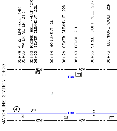
Place Blocks
Place Blocks provides the backbone of our process for creating standard drawings from Manual Walkout notes. The process begins with the preparation of a basemap containing at least a baseline (shown in red).
Once the basemap is prepared, the Data Entry task can begin, using Place Blocks. The operator is asked to Pick a Baseline, choose a scale and then enter a series of 4 values: Station, Offset, Feature Code and Label. Each entry is qualified by looking up the feature code in a user configurable library.
As each set of 4 values are entered, the Place Blocks function inserts a generic block with all the entered data stored in attributes. Each block insertion point is computed from station and offset data.
When data entry is complete, the CoriMap Block Redefine function is used to replace the generic blocks with project standard blocks.
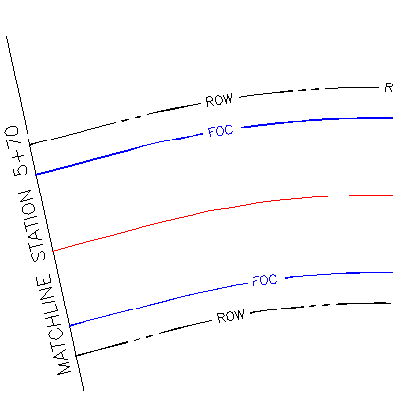
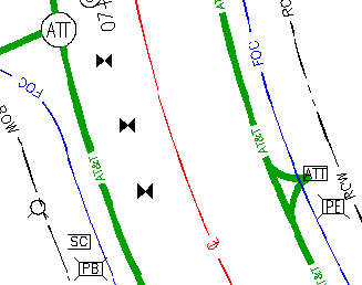
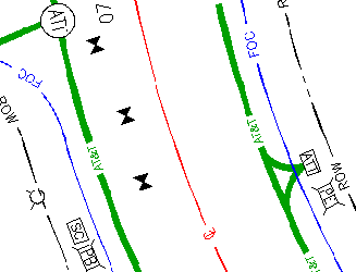
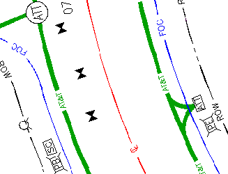
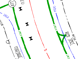
Re-Place Blocks
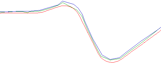
Just as our new Place Block function calculates the correct position of each block using the entered station and offset values, our new RePlace Block function reads these stored values and moves the blocks to a correct position. You can use it after changing the Station and Offset values or you can use it after changing the shape of the baseline.
Here’s an example where we RePlace the blocks after a straight road is changed to use curved linework.
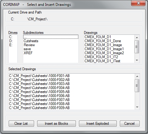
Select / Insert Blocks
The Select and Insert Drawings tool was created to automate the construction of System Drawings (a single drawing containing all drawings associated with a given pipeline or corridor system). A Dialog Box interface is provided to accommodate the selection of any drawing your computer can see. The selected drawings can then be Inserted as Blocks or Inserted and then Exploded.
Orient Blocks
This block orientation tool automatically rotates block graphics (and Not Attributes) in relation to a selected baseline. We included 4 options to suit any standard: Left, Right, In or Out. It works with blocks originally designed to be horizontal or vertical when rotated to 0 degrees. This handy utility can make fast work of a tedious rotate chore.
Here’s some examples:
Rotate Blocks
CoriMap includes several semi-automated Block Rotation tools:
Rotate Blocks offers 5 methods to rotate block graphics (independent of attributes):Absolute, Example, Flip(180), Interactive & Relative
Rotate Blocks Interactive is a repeating, freeform rotation tool. You pick a block and drag a rotation angle. Only the graphics are rotated – the attribute are not rotated.